
The Most Efficient Way to Get Your Existing Conditions Survey
In the world of architecture, engineering, and construction (AEC), accurate existing conditions surveys are the bedrock of every successful project. Yet, for too long, the industry has been reliant on outdated, time-consuming, and error-prone manual methods. Tape measures, clipboards, and hours spent on-site sketching are not just inefficient; they’re a significant drain on resources and a common source of costly project delays and rework.
At XZ Reality Capture, we believe it’s time for a change. We’re here to redefine how you approach existing conditions surveys, offering a solution that doesn’t just improve efficiency—it transforms it.
The Problem with “Traditional”
Imagine you’re tasked with renovating an older building, designing an addition, or planning a complex equipment installation. The first step is always to understand the current state of the site. Traditional methods often involve:
- Slow Data Collection: Days, or even weeks, are spent on-site, meticulously measuring every dimension.
- Human Error: Even the most skilled professionals can make mistakes, leading to discrepancies and inaccuracies.
- Incomplete Information: It’s impossible to capture every nuance manually, often leading to “return trips” for forgotten measurements.
- Time-Consuming Documentation: Translating hand-sketches and notes into digital drawings is a separate, arduous process.
- Costly Rework: Errors in initial surveys can cascade through a project, leading to expensive redesigns and construction delays.
These challenges aren’t just inconveniences; they directly impact your project timelines, budgets, and ultimately, your client satisfaction.
The XZ Reality Capture Solution: Precision, Speed, and Detail
This is where XZ Reality Capture steps in, offering the most efficient way to get your Existing Conditions Survey. We leverage cutting-edge 3D Laser Scanning technology to capture your project site with unprecedented speed and accuracy.
What is 3D Laser Scanning?
3D laser scanning uses advanced sensors to emit millions of laser points, measuring the distance to every surface within its line of sight. These points come together to create a “point cloud”—a dense, digital replica of your physical space, accurate down to the millimeter.
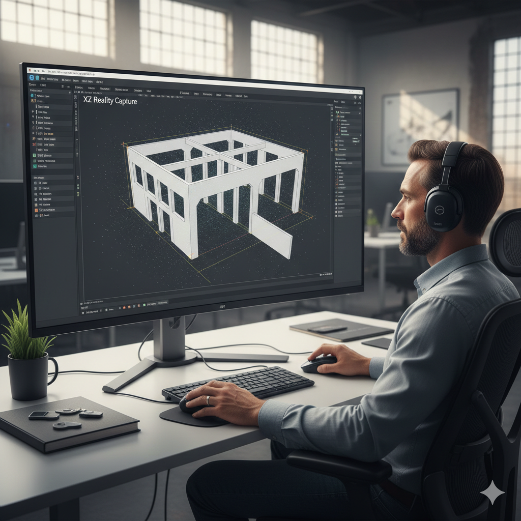
Beyond the Scan: Comprehensive As-Built Services
Our service doesn’t stop at data collection. The raw point cloud data is then meticulously processed by our expert team to create comprehensive As-Built models and drawings. These aren’t just pretty pictures; they are highly accurate, intelligent digital assets that serve as the perfect foundation for your design and construction phases.