
How to Modernize 100,000+ Sq. Ft. of Outdated Legacy Floor Plans into Active Digital Twins
For facility managers overseeing massive commercial spaces, institutional campuses, or industrial complexes, an uncomfortable truth often sits in a filing cabinet: the building’s actual physical reality rarely matches its blueprints.
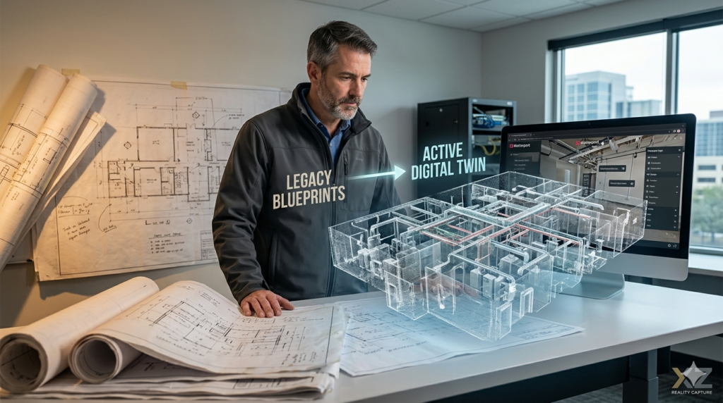
Whether you are managing a 100,000-square-foot medical facility, a sprawling corporate office, or a multi-building educational campus, relying on legacy records is a ticking time bomb of operational inefficiency.
Over decades of operations, walls are moved. HVAC systems are rerouted. Server rooms are expanded. Electrical panels are rewired. If your team is still relying on paper blueprints, faded PDFs from a 1998 renovation, or fragmented CAD files, you aren’t just working with “old” data—you are working with dead data.
Here is a look at the hidden costs of legacy building records, and a step-by-step framework for how modern facility managers are migrating from paper to pixels using 3D reality capture.
The Hidden Costs of Operating on “Dead Data”
When a facility’s documentation doesn’t match reality, every department pays a tax.
- The Subcontractor “Guessing” Tax: When a mechanical or plumbing contractor comes on-site for emergency repairs or upgrades, the first thing they do is look at the drawings. If those drawings are wrong, they spend hours field-verifying systems on your dime. Worse, they might cut into a wall expecting empty space, only to hit an unmapped conduit block.
- The Facility Management Onboarding Delay: When new operations staff or maintenance technicians join your team, their onboarding time doubles if they have to physically walk a facility for months just to learn where critical shut-off valves, assets, and MEP (Mechanical, Electrical, Plumbing) pathways are hidden.
- The Space Optimization Blindspot: If you are planning a massive spatial reorganization or modern hybrid-office layout, a 2% margin of error on a 150,000 sq. ft. building equals 3,000 square feet of “ghost space.” You cannot efficiently lease, optimize, or manage what you cannot accurately measure.
The Modern Alternative: What is an Active Digital Twin?
Migrating to a digital twin doesn’t just mean turning paper blueprints into PDFs. It means creating an accurate, cloud-accessible, 1:1 virtual replica of your physical asset.
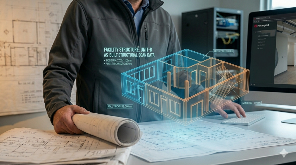
By utilizing high-speed 3D LiDAR scanning and high-resolution Matterport virtual twins, a massive facility can be digitally mapped down to millimeter accuracy.
Unlike a flat, 2D blueprint, an active digital twin allows facility managers to:
- Virtually Walk the Facility: Inspect structural elements, ceiling plenums, and mechanical rooms from a laptop anywhere in the world.
- Embed Asset Data: Click on an HVAC unit inside the digital twin to instantly view its model number, maintenance history, installation date, and operation manuals.
- Streamline Operations: Instantly share exact spatial links with third-party vendors so they can bid on projects remotely without needing disruptive, repeated on-site walkthroughs.
A Step-by-Step Blueprint for Modernizing Massive Facilities
Transforming a legacy facility footprint can feel overwhelming. However, by breaking it down into a structured reality capture workflow, the process can be completed with zero disruption to daily building operations.
Step 1: The Spatial Audit & Scope Alignment
Not all square footage is created equal. The first step involves defining your operational goals. Do you just need highly accurate architectural As-Builts to plan a spatial redesign? Or do you need an intensely detailed MEP model to manage complex boiler rooms and electrical infrastructure? Aligning your goals ensures you capture the exact Level of Detail (LOD) your operational team needs without overpaying.
Step 2: Non-Disruptive 3D Terrestrial & LiDAR Scanning
Using advanced terrestrial laser scanners, a reality capture team can document millions of data points per second. For large-scale active facilities (like medical centers or corporate headquarters), scanning can be scheduled in phases or after-hours. Because the lasers capture spatial data at the speed of light, an experienced team can document tens of thousands of square feet a day without interrupting staff or operations.
Step 3: Processing the Point Cloud to Scan-to-BIM
Once the physical data is captured, the millions of individual data points (the “point cloud”) are compiled into a unified, accurate coordinate system. From here, specialized BIM modeling technicians translate that raw data into highly functional Autodesk Revit models or detailed 2D CAD files. The result? A perfectly precise, “As-Built” digital record of the building as it stands today, not as it was designed thirty years ago.
Step 4: Activating the Digital Twin
The final step is moving the data out of the silo and into the hands of your team. By hosting the data in cloud-accessible formats (such as Matterport or integrated Procore/BIM platforms), your entire ecosystem—from senior stakeholders and asset managers down to the night-shift maintenance crew—has instant access to the exact same source of truth.
Future-Proofing Your Facility
The buildings that operate most efficiently in the coming decade will be the ones that treat their spatial data as a dynamic asset rather than a static piece of paper.
By taking your facility from paper to pixels, you reduce vendor friction, slash maintenance delays, and gain an unparalleled level of control over your square footage.
Ready to see what your facility looks like in high-definition? Contact XZ Reality Capture today to discuss how we can transform your legacy floor plans into an accurate, operational digital twin.