Managing a construction site means keeping dozens of moving parts on schedule, on budget, and within scope. But traditional manual site surveys, physical inspections, and manual material calculations take days — often yielding outdated data by the time the report hits your desk.
At XZ Reality Capture, we’re expanding our aerial services to bring general contractors, site engineers, and project managers fast, centimeter-accurate spatial data delivered straight into your existing BIM and CAD workflows.
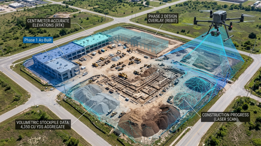
4 Ways Aerial Reality Capture Elevates Your Job Site
1. Construction Progress & Site Documentation
Stop relying on fragmented phone photos and manual site walks. Routine, automated drone flights capture complete visual histories of your job site over time.
- Schedule Verification: Compare real-world progress against your project timeline.
- Dispute Resolution: Maintain a permanent, timestamped visual record of slopes, elevations, and structural milestones.
- Stakeholder Transparency: Keep off-site investors, owners, and leadership aligned with up-to-date visual progress reports.
2. High-Precision Surveying, Earthworks & Volumetrics
Measuring aggregate stockpiles or calculating cut/fill volumes manually is slow, costly, and hazardous. Using Real-Time Kinematic (RTK) drone technology paired with physical Ground Control Points (GCPs), we deliver topographic surveys with true centimeter-level precision.
- Topographic contour mapping & Digital Elevation Models (DEMs)
- Accurate stockpile volume measurements for earthmoving and raw materials
- Fast site condition assessments prior to groundbreaking
3. Safe Facade & Roof Inspections
Inspecting high-rise structures, complex roofs, or hard-to-reach envelopes historically meant expensive scaffolding or risky ladder climbs. Our high-resolution aerial photogrammetry captures every detail safely from the ground, providing ultra-clear orthomosaics for detailed as-built documentation.
4. Interactive 3D AEC Platforms & Digital Twins
Bring your developments to life before or during construction. We create immersive 3D digital twins and interactive plats that enable investors, buyers, and planning boards to explore project developments remotely from anywhere in the world.
Seamless Integration — Zero Extra Friction
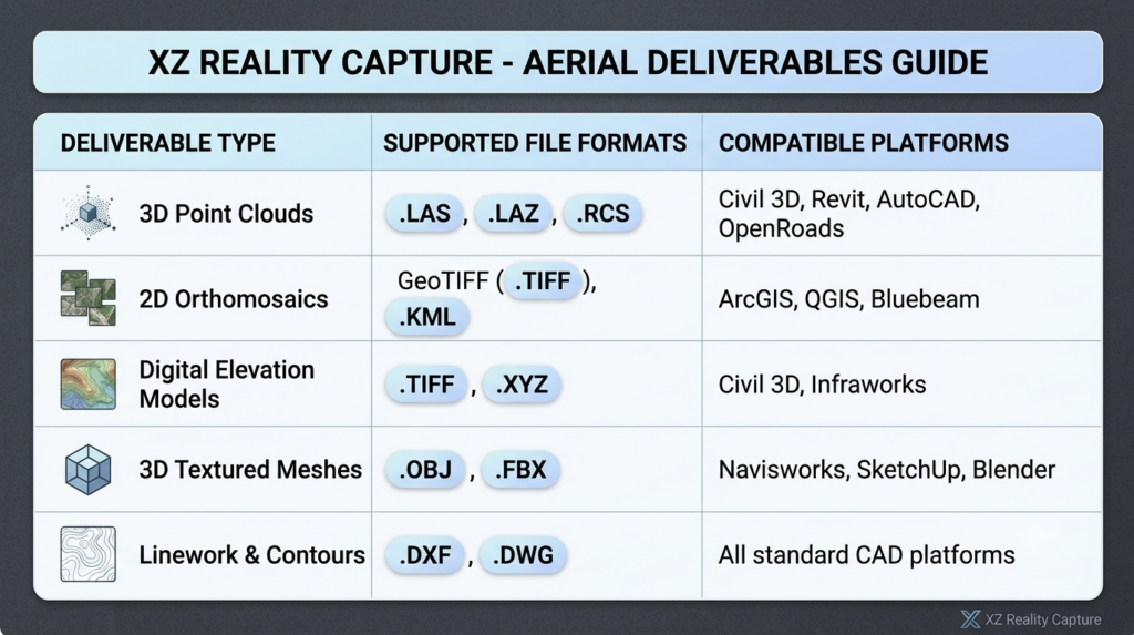
Data is only as valuable as its usability. We don’t just hand over raw photos; we deliver georeferenced, actionable spatial models engineered to plug straight into the software your design and engineering teams already use every day.
Ready to Upgrade Your Site Intelligence?
Whether you need weekly progress tracking, precision volume reporting, or a complete 3D digital twin of your job site, XZ Reality Capture delivers spatial data you can trust.
📍 Serving the Austin–San Antonio region and projects nationwide.
👉 Schedule Your Free 30-Minute Consultation with XZ Reality Capture to discuss your upcoming project requirements or request a custom quote.