Every architect, general contractor, and property developer has experienced the same nightmare: design work is nearly finished, contractors are on site, and suddenly a structural column or HVAC duct appears exactly where a main doorway was supposed to be. The culprit? Inaccurate as-built documentation.
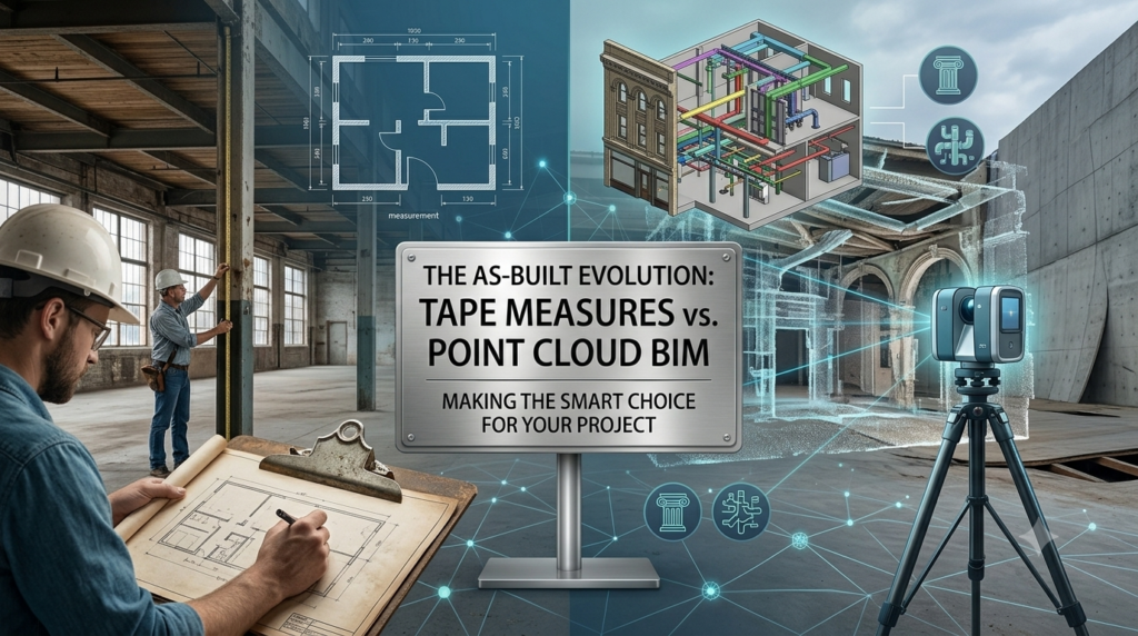
In real estate redevelopment, adaptive reuse, and commercial renovation, your design is only as reliable as the measurements framing it.
For decades, establishing as-built drawings meant sending a team to the job site armed with tape measures, handheld laser distance meters, clipboards, and camera phones. Today, 3D Laser Scanning (LiDAR) and Point Cloud processing have triggered a paradigm shift across the Architecture, Engineering, and Construction (AEC) industry.
If you are planning your next property project, here is how traditional reality capture stacks up against modern 3D laser scanning—and why making the leap to point cloud data could save you tens of thousands of dollars in hidden rework.
What Is the Difference?
Understanding the contrast between traditional and modern reality capture comes down to how data is gathered and translated into usable plans.
The Manual Approach: Tape Measures & Manual Drafts
Traditional as-built documentation relies entirely on physical human observation and selective manual entry:
- A team physically measures distances between walls, openings, and fixtures using handheld tools.
- Measurements are hand-sketched onto existing paper blueprints or blank floor plans.
- Back at the office, a CAD draftsman manually interprets those hand notes to recreate 2D floor plans, elevations, and sections from scratch.
The Modern Approach: 3D Laser Scanning & Point Clouds
LiDAR (Light Detection and Ranging) technology replaces manual measurement with millions of high-speed laser pulses:
- The Scan: A 3D scanner rotates in a space, recording precise three-dimensional spatial coordinates ($X, Y, Z$) for every surface within its line of sight.
- The Point Cloud: Millions of individual spatial points are stitched together using specialized registration software, creating a photo-realistic, digital 3D replica of the physical environment.
- BIM / CAD Modeling: The point cloud is imported directly into software like Autodesk Revit or AutoCAD. Designers then build hyper-accurate 2D drawings or 3D Building Information Modeling (BIM) elements directly over the point cloud overlay.
Reality Capture Side-by-Side
| Metric / Feature | Manual As-Builts | 3D Laser Scanning & Point Cloud |
| Speed (Site Time) | Slow (Days to weeks depending on square footage) | Fast (Hours to a few days for massive facilities) |
| Measurement Accuracy | High risk of human error | Millimeter-level precision |
| Scope of Data | Selective (Captures only what the surveyor actively targets) | Comprehensive (Captures everything visible in line-of-sight) |
| Site Visits Required | Multiple (Re-visits are frequently needed to verify missed items) | Typically One initial scanning session |
| Complex Geometries | Extremely difficult (Arches, historic details, out-of-square walls) | Seamless (Easily records organic curves and complex pipe runs) |
| Upfront Cost | Low equipment overhead / Labor-heavy | Dedicated equipment investment or specialist service fee |
| Overall Project ROI | Low (High downstream risk of change orders and delays) | High (Eliminates field clashes and cuts structural change orders) |
Deep-Dive Comparison
1. Accuracy and the Elimination of Human Error
Manual measurements carry inherent human vulnerabilities: misread tape measures, transposed numbers on a clipboard, or miscommunicated hand sketches.
More importantly, traditional drafting relies on the faulty assumption that buildings are straight. Older structures rarely feature perfectly $90^\circ$ right-angled corners, vertical walls, or level floors. While a surveyor with a tape measure assumes a room is square, a 3D laser scanner captures floor sags, non-plumb structural walls, and warped ceiling joists down to the millimeter.
2. On-Site Speed and Worker Safety
Measuring high ceilings, double-height lobbies, active mechanical spaces, or exterior facades traditionally requires ladders, scaffolding, or bucket lifts. This slows down the process and introduces clear safety hazards to site personnel.
By contrast, a single 3D scanning technician can set up a tripod on the floor and capture full $360^\circ$ spatial scans—including hard-to-reach overhead mechanical infrastructure—in just a few minutes per scan position without ever leaving the ground.
3. Data Completeness and the “Digital Twin”
The biggest hidden cost of traditional surveys is the return site visit. If a draftsman realizes midway through design that a window height or breaker panel location was omitted, someone has to drive back to the physical building to measure it.
With 3D laser scanning, the registered point cloud serves as a complete “digital twin” of the building. If you need a new dimension six months into the design phase, you simply open the point cloud file in your modeling software and measure it virtually in seconds.
Choosing the Right Methodology for Your Project
While 3D laser scanning is transforming reality capture, choosing the right strategy depends on project scope, complexity, and budget.
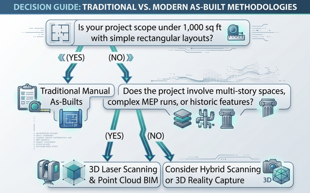
Stick with Manual As-Builts when:
- The project scope is small (e.g., a simple residential room renovation under 1,000 sq ft).
- The layout is strictly rectangular with standard non-complex details.
- The budget cannot accommodate specialized scanning equipment or service fees.
Choose 3D Laser Scanning when:
- The building exceeds 5,000+ sq ft or spans multi-story, interconnected commercial spaces.
- You are working within active industrial facilities or complex Mechanical, Electrical, and Plumbing (MEP) environments.
- The structure features historic preservation elements, curved architecture, or non-standard geometries.
- Your project team utilizes BIM/Revit workflows and requires a clash-free baseline model before construction begins.
Transform Your Reality Capture Strategy
While manual tape measurements may seem cost-effective on paper, hidden field errors, return site visits, and expensive change orders during construction quickly erode those savings. 3D laser scanning delivers unprecedented accuracy, slashes design timelines, and gives your project team complete confidence from day one.
Ready to upgrade your property documentation workflow?
Whether you need a full 3D point cloud scan or a complete scan-to-BIM model for your next development project, our team of reality capture specialists is ready to help. Contact our experts today for a free project assessment and quote to see how 3D laser scanning can safeguard your project’s timeline and budget.