
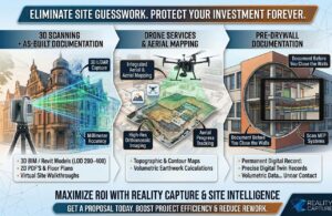
Stop Guessing On-Site: How Reality Capture and Drone Intelligence Protect Your Project’s ROI
Every construction manager or facility operator knows the sinking feeling of discovering an in-wall utility conflict or realizing manual field measurements were off by critical inches. These site discrepancies lead to the same predictable results: costly rework, schedule delays, and budget overruns. In today’s fast-paced AEC industry, relying on tape measures, manual land surveys, and paper site plans isn’t just outdated—it’s a risk to your bottom line. By bringing together 3D Laser Scanning, Aerial Drone Intelligence, and Pre-Drywall Documentation, modern
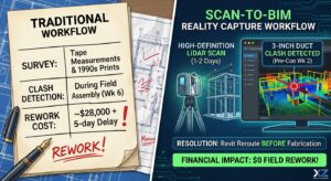
The Hidden Cost of Rework: How Pre-Construction Reality Capture Pays for Itself on Day One
In commercial construction and adaptive reuse, few phrases make a Project Manager wince quite like “field modification required.” Whether it is a heavy HVAC main duct striking a newly placed structural beam or a plumbing stack misaligned with an overhead sleeve, MEP (Mechanical, Electrical, and Plumbing) conflicts are among the leading drivers of budget overruns in commercial projects. According to industry data from the Construction Industry Institute (CII), direct rework typically consumes 5% to 10% of total construction costs—a massive
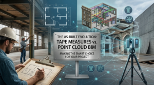
Traditional As-Builts vs. 3D LiDAR Scanning: The Paradigm Shift in Reality Capture
Every architect, general contractor, and property developer has experienced the same nightmare: design work is nearly finished, contractors are on site, and suddenly a structural column or HVAC duct appears exactly where a main doorway was supposed to be. The culprit? Inaccurate as-built documentation. In real estate redevelopment, adaptive reuse, and commercial renovation, your design is only as reliable as the measurements framing it. For decades, establishing as-built drawings meant sending a team to the job site armed with tape
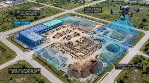
Centimeter Accuracy from Above: XZ Reality Capture’s Drone Services for AEC
Managing a construction site means keeping dozens of moving parts on schedule, on budget, and within scope. But traditional manual site surveys, physical inspections, and manual material calculations take days — often yielding outdated data by the time the report hits your desk. At XZ Reality Capture, we’re expanding our aerial services to bring general contractors, site engineers, and project managers fast, centimeter-accurate spatial data delivered straight into your existing BIM and CAD workflows. 4 Ways Aerial Reality Capture Elevates
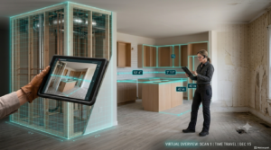
Boots on the Ground 24/7: How Matterport 3D Tours Are Revolutionizing Renovation Management
Managing a renovation project can feel like a full-time job on top of your actual full-time job. Whether you’re a real estate investor managing a fix-and-flip from three states away, or a homeowner trying to keep tabs on a kitchen remodel while at the office, the burning question is always the same: How was the site 3 weeks ago and what’s the progress now? Traditionally, getting the answer required “boots on the ground”—driving out to the site, scheduling walkthroughs, or

Is Your Facility Operating on “Dead Data”? 🏢
If you manage a commercial property, a corporate campus, or an institutional facility over 100,000 square feet, take a quick look at your current building documentation. Are you relying on rolled-up paper blueprints, a folder full of disconnected PDFs, or CAD files from a renovation that happened five years ago? If so, your facility is operating on dead data. Dead data is spatial information that is static, isolated, and rapidly decaying. The moment a contractor moves a wall, an engineer